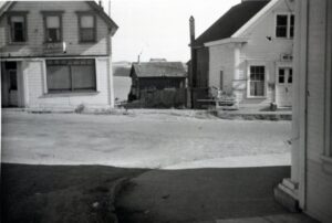
The inspiration for the latest exhibit at the Kelley House Museum, South of Main, came from a question we so frequently hear – what used to be there? The THERE refers to the south side of downtown Mendocino’s Main Street, where there are no buildings. Museum visitors, walking tour docents, residents – all wanted to know what was there before the Headlands State Park came into being.
The historic district status of Mendocino has produced reams of information on most of its buildings, but the 20-plus structures located on this side of Main Street were not documented since they were all demolished by 1960, years before the historic preservation process really started to get underway around here.
Despite old photographs showing buildings on both sides of the street, this area remained a little mysterious, and had received little study. Until now.
Two powerful resources, which were always available but are now more easily accessible, came together to reveal this new landscape. The first is the series of Sanborn Fire Insurance Maps that depicts the town and labels all of its buildings with their uses – store, dwelling, post office, meat market, etc. Maps are such a wonderful communication graphic because they can, with a glance, condense a lot of data and relate it to other information.
The Kelley House Museum has Mendocino’s Sanborn maps starting in 1883, and proceeding through time to 1890, 1894, 1898, 1903, 1909 and 1929. With a continuum like this, one can compare and trace the development of the town and its structures. We have had these maps in our archives for years, but they are now available in digital format from the Library of Congress. This makes them so much easier to see for the close study required in this work.
The second research tool only recently arrived when genealogist Phil Carnahan of Ukiah gifted to local historical organizations digital scans of all the coastal newspapers. For many years, we have used the Beacons, stored in their physical form in the archives. But these scans are something else. While they may simply look like old newspaper pages on the screen, these are PDFs that are formatted for keyword searching. This allows people to efficiently mine them for the names of businesses, people, and events, which can then be assembled, clue by clue, to create a fuller picture.
This means that we can now construct detailed building timelines. As an example, we have a good start on the Meat Market building, which was located, until 1960, where Kasten Street meets Main. It was the last structure along this stretch to be razed. We knew from photos and maps where the market was, and we knew that various people were mentioned here and there in our files as butchers or had a business called this or that meat market.
But with these new searches, we can now stitch together these fragments and document the history of that long-gone building with the names of the various owners (some we didn’t even know about before), when they came and went, and sometimes, who had the shop next door. Biographical data from various genealogical sources can then be added, bringing the place to life with the people that lived and worked here before.
It’s exciting work and the Museum is using an exciting new format to share these discoveries. Thanks to funds given to us by Alan Escola, the exhibit is being presented on a beautiful, new 50-inch computer screen in the Escola Room, our main exhibit space named for his late grandmother, local historian Nannie Escola. Here, visitors can scroll through the South of Main story using an interactive, multimedia digital platform called a Story Map, which presents a curated photo tour of what we’ve found.
Check out the South of Main Story Map here: https://storymaps.arcgis.com/stories/662fbb327e4c4c748ead824996a67c07
Kelley House Museum is open Fridays through Mondays 11am to 3pm. Contact us at 707/937-5791 or curator@kelleyhousemuseum.org